Online Shop

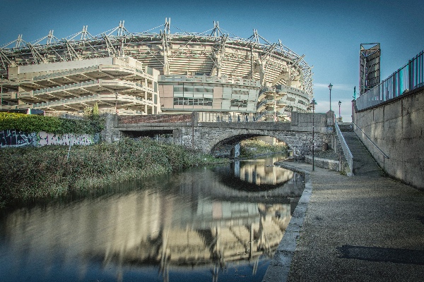
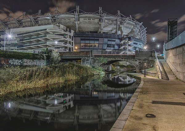
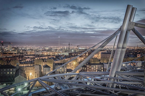
The last few weeks have been a blur for me. The reaction of people to my images has taken me totally off guard. I am so grateful for all the support and encouragement shown to me and my work...it means a lot to me.

IMG_4553.JPG

I'm delighted to announce that I am currently updating my site to include for an online shop, where prints of my images can be purchased. 

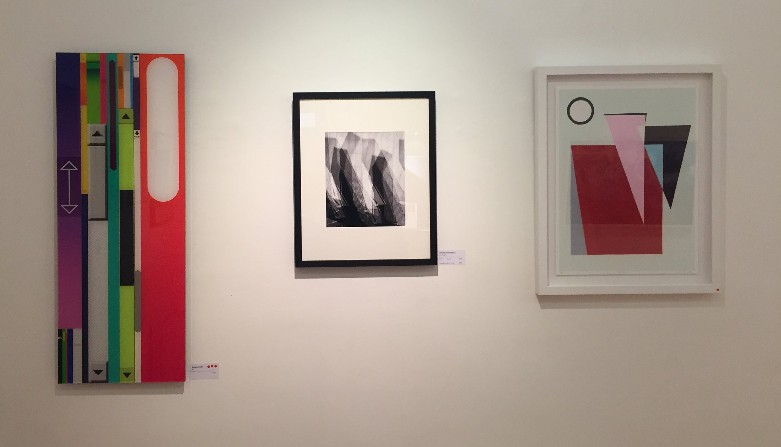
The images are Glicée Prints with pigment archival inks on archival photo-rag paper, giving a beautiful matt finish to the works. I just got some test prints back, and they are stunning. The online versions of these images do not do justice to the full level of detail seen in the printed versions.

A variety of sizes will be available.

I'll be posting more info soon.

I'm excited & terrified in equal measure... 

Onwards & upwards.  

Thundercut Alley

Possibly the coolest named Alley ever. I like how the design included this alley in the redevelopment of Smithfield...there was always one here.  

IMG_3447.JPG

Thundercut Alley ran from Queen Street to Smithfield just south of where Fresh supermarket is today, on the North West side of Smithfield.

Thundercut Alley, 1979 - Dublin City Council Photographic Collection

Thundercut Alley, 1979 - Dublin City Council Photographic Collection

Rocque 1756 - UCD Digital Collection

Rocque 1756 - UCD Digital Collection

'Thunder and Martin, ale and beer brewers' occupied 14, 15, 16 & 17 Church Street New, which runs from Smithfield to Bow Street on the east side of Smithfield.

Ordinance Survey Ireland 1837-1842

Ordinance Survey Ireland 1837-1842

Ordinance Survey Ireland 1888-1913

Ordinance Survey Ireland 1888-1913

The brewery occupied that location from 1823 until at least 1851. The 1853 Thom's Directory listing 14, 15, 16 & 17 Church Street New as 'vacant' (1852 Thom's - pages missing). Vincent Samuel & Son, iron foundry, is listed for the location in the 1855 Thom's Directory. Prior to 1822, 'Thunder (Andrew and Michael), brewers' is listed as at 11 Bow Lane, which was just around the corner from Church Street New. Bow Lane is now part of present day Bow Street. 

Smithfield

Smithfield

The Blessington Basin

The Blessington Basin - always an oasis of calm for me in the city. I go through here as often as I can.

FullSizeRender.jpg

I always find it fascinating the way things change in the city over time. Just behind here is a linear park, called Blessington Street Park, extending from Phibsborough down almost as far as Broadstone to the South.

Blessington Street Park to the west of the Blessington Basin - image from Google Earth

Blessington Street Park to the west of the Blessington Basin - image from Google Earth

This park is actually the ghost of the Broadstone line of the Royal Canal. that originally ran all the way to a harbour at Broadstone, where Dublin Bus have a depot now. 

Broadstone bus depot

Broadstone bus depot

The name Broadstone itself is descriptive of a stream crossing; the Bradogue, one of Dublin's many rivers, runs by here. The Bradogue rises in Cabra and runs to the Liffey at Ormond Quay. It is almost entirely culverted now and runs almost totally underground. 

In earlier times the stream was crossed by means of a large, oblong stepping stone - the broad stone, located near present day Constitution Hill. 

Ordinance survey Ireland 1837-1842 with the Broadstone line coloured blue

Ordinance survey Ireland 1837-1842 with the Broadstone line coloured blue

The Harbour at Broadstone was close to the city markets and to numerous nearby institutions including the Richmond Penitentiary, the Richmond Lunatic Asylum, the North Dublin Union Workhouse, the Female Penitentiary, the Linen hall, and the King's Inns (later known as the King's Inns) 

Broadstone Harbour, with the King's Inns in the background, early 1820s. 

Broadstone Harbour, with the King's Inns in the background, early 1820s. 

There was a Royal Canal Hotel at Broadstone; that was where passenger-carrying boats departed from. The newly extended Luas will soon be taking passengers from this location once more. 

Ordinance Survey Ireland 1888-1913 with the Boardstone line highlighted in blue

Ordinance Survey Ireland 1888-1913 with the Boardstone line highlighted in blue

Croke Park Skyline Tour

I made my way back to Croke Park for my second tour of the Ericsson Skyline tour at dusk, organised again by Igersdublin

It was a beautiful day for it, so I took the opportunity to get down early to get a few external shots of the iconic building in context. 

The Royal Canal running by Croke Park

The Royal Canal running by Croke Park

Night-time view from same location  (2016)

Night-time view from same location  (2016)

The stadium towering over adjoining residential properties on Jones' Road

The stadium towering over adjoining residential properties on Jones' Road

Dublin doesn't have many publically accessible, elevated vantage points. At 17 storeys up, this is Dublin's highest open-viewing platform, with amazing panoramic views over the city.

I used to almost exclusively do panoramic photos. I haven't done any for ages, but with this view it would have been rude not to try capture as much of it as I could... 

A 13 image, stitched panorama of the view across the city

A 13 image, stitched panorama of the view across the city

An 8 image, stitched panorama of the view across the city

An 8 image, stitched panorama of the view across the city

There's a whole lot of Dublin going on down there...

Towards the South-West

Towards the South-West

Toward the North Circular Road, with Pavee Point Centre (formally The Free Church, built in 1800 and initially known as 'Wesley Chapel') in the background

Toward the North Circular Road, with Pavee Point Centre (formally The Free Church, built in 1800 and initially known as 'Wesley Chapel') in the background

Junction of Great Charles Street & the North Circular Road

Junction of Great Charles Street & the North Circular Road

Junction of Great Charles Street & the North Circular Road

Junction of Great Charles Street & the North Circular Road

towards the South-East

towards the South-East

Towards the South

Towards the South

Towards the Spire (2016)

Towards the Spire (2016)

Roof structure in the foreground, the Spire in the background

Roof structure in the foreground, the Spire in the background

At this stage I couldn't feel my fingers. That beautiful day had turned into a freezing evening...and in my wisdom, I forgot to bring my gloves. Rookie error. 

On my way out, as my finger's thawed, I got some last images of the Stadium itself. What a space. What drama has occurred within these walls. Victory and defeat in equal measure...dreams are made and destroyed every year on this pitch and in these stands.

The stadium

The stadium

The Hogan Stand  

The Hogan Stand  

The Hogan Stand (2016)

The Hogan Stand (2016)

Under the Cusack Stand

Under the Cusack Stand

As a Cavan man, unfortunately I haven't got to cheer my county here too often...but our time will come. Just you wait and see.

An Cabhán Abú!

As an Irishman though, a visit here is always a visit to hallowed ground.

The Irish Life Centre

Dublin had quite the surprise for me on my walk home from work yesterday evening. As I walked along Talbot Street I passed the entrance to the Irish Life Mall. I hadn't been through it in years so thought I'd take a little detour. 

Oisín Kelly’s Chariot of Life sculpture in the front forecourt, facing Abbey Street

Oisín Kelly’s Chariot of Life sculpture in the front forecourt, facing Abbey Street

My first thought was how dated the mall's interior looked...but what great potential it has, if shown a bit of love to drag it, kicking and screaming, out of its flares and into 21st century skinny jeans.

Advert for the planned Irish Life Centre from 1977 - found in Brand New Retro

Advert for the planned Irish Life Centre from 1977 - found in Brand New Retro

Entrance from the East (Gardiner Street) 

Entrance from the East (Gardiner Street) 

Designed by one of Ireland’s most important modernist architects, Andy Devane, it was the first major mixed-use development in Dublin City, and has been the HQ of Irish Life since the building’s completion in 1980.  

Secondary entrance plaza off Abbey Street

Secondary entrance plaza off Abbey Street

As I rambled through the centre I came across a set of steps that I hadn't noticed before. Not being in a rush, I thought I'd have a look. As I walked up the steps I was surprised to find a fountain come into view. The space opened up to a generous, planted courtyard space. 

Courtyard space, with Liberty Hall in the background

Courtyard space, with Liberty Hall in the background

Covered pathways meander through the space, with offices at courtyard level and a mix of offices and apartments over. 

Courtyard  

Courtyard  

There's a generousity to this space; ample planting, the background sound of water, small spots to stop and sit for a chat...exactly what a public space should be. 

FullSizeRender.jpg

It's dated, sure...it kind of reminded me a bit of some set from Star Trek, the original series. That aside, it is a strong example of late 1970s thinking on density, permeability and inner-city multi-purpose usage; the site achieved considerable density, but not at the cost of quality public open space.

Oisín Kelly’s Chariot of Life sculpture in the front forecourt, with the Custom's House in the background

Oisín Kelly’s Chariot of Life sculpture in the front forecourt, with the Custom's House in the background

I'm old enough to remember the late 70's and early 80's...I have fond memories of Angel Delight desserts, SPAM and Big Daddy vs Giant Haystacks.

Not everything from back then was awful though; today's architects and planners could learn a thing or two from this development.

I might start a trend; platform shoes & skinny jeans. Take that ye Fashionista police...

Marlborough Place

There has been an open space here in every map I've seen of the area. In fact, seemingly an open space can be traced back here as far back as the 12th Century. 

IMG_3147.JPG

I had mistakenly assumed that it had been used as a small market area, but it actually was a public open space, named Marlborough Green. 

Rocque, 1773 - UCD Digital Archive 

Rocque, 1773 - UCD Digital Archive 

Located in the area between present day Lower Abbey and Talbot Streets, the square shaped gardens and green was bordered on the east by the Old Rope Walk.

Beyond, where once barley fields, windmills, glass houses and huddled hamlets dotted the landscape, now avenues lined with stately mansions, imposing, brick fronted charitable institutions and cluttered back lanes of higgledy hovels and turf fired cabins spread eastwards from the old city.

Modern Plan of the city & environs of Dublin 1798

Modern Plan of the city & environs of Dublin 1798

It developed gradually from a bowling green into a pleasure garden. The Hibernian Journal of 15th October 1703 says;

“The new Bowling Green in Marlborough Street has also a handsome house with two Billiard tables, Card House with Card tables, and a house to shelter the gentlemen when raining”

Ordinance Survey Ireland 1837-1842

Ordinance Survey Ireland 1837-1842

On the seaward side of Marlborough Green was World’s End Land where the city fathers were already planning the embankment of the river, and the division and allotment of the Liffey’s floodplains. At Hawkin’s Wall south side dwellers queued for the short ferry journey across the Liffey. Stepping out onto Ferry Boat Lane on the north side, a short stroll past the velvet factory brought revellers to the green, overlooked by the Earl of Tyrone’s magnificent new stone house.

So popular was the bowling green and gardens that the crowds of up to 1,200 attended events. On such nights the young people would spill out onto the terrace to dance or to stroll through the moonlit gardens.

And thus the high living Richard Nugent, Lord Delvin, happened upon Captain George Reilly and his young female companion in the music rooms of Marlborough Gardens, on the 30th July 1761. Delvin was challenged to a duel by Reilly, after Delvin acted improperly to the lady in Reilly's company, and refused to apologise for his conduct.

Ordinance Survey Ireland 1888-1913

Ordinance Survey Ireland 1888-1913

One account of the duel states that, despite a great show of bravado, Delvin did not know that his sword was supposed to be out of its scabbard before being used, and perhaps, as a consequence he was promptly ran through by Reilly. He died of his injuries a week later, on the 6th August, aged just 19.

Fashionable society, more sensitive to scandal than today, was so shocked that it never again frequented the Narlborough bowling green. In time the neglected gardens were swallowed up by the city as it marched eastward.